Back to the seashore

Our hotel in Newtownards was perfectly serviceable even if it wasn’t in the most scenic of locations – the view from my bedroom window was a wall about 1 foot away!. We had walked up to Ballywalter on the coast yesterday and then Helen picked us up and took us to Newtownards for the night. Today we would walk back to Ballywalter and then up to Donaghadee. During the Great Famine, which resulted from the dependence of small tenants and cottiers on a blighted potato crop, the largest Newtownards local landowner, Lord Londonderry, rejected rent reductions on grounds of “personal inconvenience”. By 1847 the 800 inhabitants of the town were witness to “emaciated and half-famished souls” queuing at soup kitchens and overflowing the newly built workhouse. Despite Lord Londonderry’s objection, with the upgrading of the road to Donaghadee, several public works programs for famine relief were instigated.

Walking eastwards out through Newtownards there was an extensive array of plaques and murals showing the local affiliation. The tower in the last picture is the Scrabo Tower, a 135 feet (41 m) high 19th-century lookout tower or folly that stands on Scrabo Hill. It provides wide views and is a landmark that can be seen from afar – we saw it from Portaferry (16 miles / 25 km away). It was built as a memorial to Charles Vane 3rd, 3rd Marquess of Londonderry and was originally known as the Londonderry Monument.

As we finished our cross country jaunt we came back to Ballywalter and could see the sea again with the Belfast / Isle of Man or Liverpool ferry also visible. The Scrabo Tower was still visible also in an area dominated by rolling fields and large farm buildings. King Billy got quite a few mentions on walls as well – also called William of Orange because he was from Orange in the Dutch Republic. He married his cousin Mary, which later gave him a claim to the English crown where he became King William III of England.

The walk from Ballywalter up to Donaghadee was right beside the sea for the most part and we took advantage of some softer underfoot terrain by walking on the beach when possible. As one stage we did have to race the incoming tide to make sure we could get to a handy exit spot from the beach!

Arriving on Donaghadee the wind was calm and the sun was (sort of) out, so we wandered up to the top of the harbour with some nice views back to the pretty town and of the lighthouse. The bottom left picture shows the route of the North Channel swim, it typically starts at Donaghadee and finishes on Scotland’s Rhins of Galloway – a minimum distance of 34.5 km (21.4 miles). The World Open Water Swimming Association notes that the North Channel is part of the Ocean’s Seven series. This is a set of seven long-distance open-water swims considered the marathon swimming equivalent of the Seven Summits mountaineering challenge. No ice cream today as the opportunity for a Guinness / beer in the sunshine was too good to be missed.

Tomorrow promises to be a very wet and windy day as we walk (a thankfully shorter route) to Bangor.

Just beachy…

The guest house in Portaferry was another strange place. Apparently closed but still taking bookings. It was clean and comfortable enough so no complaints. Portaferry played quite a part in the Irish linen industry. Many of the women in the town were employed to embroider handkerchiefs for Thomas Somerset and Co., one of the major linen companies in Ireland. The company realised that the women were more productive in the summer due to the light, so installed the first electric light outside of Belfast in Ulster. Each house with a working woman was given one light fitting and bulb. There was also a bus service introduced to bring more women from the Ards Peninsula to Portaferry to work in the factory that Somerset built.

We had originally planned to walk along the shores of Strangford Lough to Newtownards but a recce earlier in the week showed the road to be potentially very dangerous so we had a change of plan. We headed south from Portaferry along the loch shore along a nice quiet road with good views of the loch.

Continuing down around the bottom of the Ards Peninsula, the tide was out (it runs at 4 m/s in the channel!) we came upon an abandoned red phone box – the phone os still present inside, smothered in weeds. Rumour has its that if you use your credit card then the phone still works.

You will need the sound up for this. We passed by a herd of young bullocks and played then some Bach. They seemed fascinated !

We passed by Quintin Castle which has been extensively refurbished and changed hands most recently in late 2006. The latest owner had trouble with upkeep, in particular paying of renovation works, forcing the castle into the hands of administrators in 2012. In June 2013 Quintin Castle was sold (asking £1.65m with 22 acres) by NAMA to the Tayto Group  (owned by the Hutchinson family’s Manderley Food Group), which in July 2016 applied for permission to use the Castle as an 8-bedroom private function venue for weddings, visiting customers, training and conferences. Then, after a nice walk on one of the sandy beached we passed the “stump”, or remains, of the Kearney Windmill before triggering the goose alarm in a nearby house – they made so much noise as we were taking a photo the old lady owner came out to see what was up!

It really was a lovely walk today, past so many lovely beaches – it was pity the wind was so strong and so cold. Nevertheless we managed another walk on a deserted beach (that’s Paul in the distance – he had to stop for a pee). We stopped to chat to a man laying out seaweed to dry on the breakwater. The seaweed is Dulse and has all kinds of therapeutic qualities – he sells it, dried, for £10 a pound bag at the weekend markets.

It felt very weird that the whole sea front, villages of Cloughy, Ringboy and Portavogie has no pubs, no cafes and no restaurants. There was, however a very old shipwreck on Portavogie beach, a seal in Portavogie harbour and finally a cafe where we stopped for a bit of lunch (walking into the headwind was very wearying). We took a quick photo at the easternmost point of Northern Ireland in Ballyhalbert and finished our days walking at Ballywalter and has a nice sit in the sun, with an ice cream, while waiting for Helen to pick us up and take us back to Newtownards for the start of tomorrows walk.

Don’t pay the ferryman

We stayed in a very nice B&B, although a bit strange as no-one on site – all keys in individual key boxes, bar was an honesty bar and breakfast was a sort of continental affair.

Our B&B was in Bryansford, rather than Newcastle itself, and the village has a successful Gaelic football team,  Bryansford GAC. The team has won the Ulster Senior Club Football Championship twice, in 1969 and 1970. They play their home matches in St. Patricks Park in the nearby town of Newcastle. Today promised a much better weather experience than yesterday although it was still cold enough to require jackets as we started out heading through the small village of Clough and on towards Downpatrick. A few cute lambs and a loopback to yesterdays mountains were the scenic highlights of the first part of the day.

Walking into Downpatrick we passed by the Downpatrick Racecourse. This is one of the two horse racing courses in Northern Ireland, (the other being Down Royal).  The first race meeting at Downpatrick was held in 1685 under the charter of James II of Englandwho issued letters patent creating The Royal Corporation of Horse Breeders in the County of Down. After a nice deli sandwich on Downpatrick for lunch we continued our progress towards the Strangford Ferry by passing through Saul. When St Patrick came to Ireland strong currents swept his boat from the Irish sea through the Strangford Lough Narrows and he landed at the Slaney River, near Downpatrick. The High King’s brother, Dichu, was quickly converted and gave him a barn or Sabhall in Gaelic, from which the name Saul derives. This became the first church in Ireland.

Just after Saul we passed by Ireland’s national monument to Saint Patrick. Slieve Patrick is a large hill in Lecale donated by the Hampton family for the erection of a National Monument. The statue on the top is the world’s largest statue of Saint Patrick, carved of Mourne Granite near Kilcoo the statue is unusual as it has a workman’s boot on one foot and a sandal on the other to commemorate the quarry men. From the top of the hill there are excellent views over Strangford Lough. You can also see Saul Church, the Isle of Man, and the Mull of Kintyre on a clear day.

The end of our second days walking came as we got to the ferry between Strangford and Portaferry on Strangford Lough. In 1611 James I granted land on either side of the Lough to Peirce Tumolton in order to maintain and crew a ferry boat. In 1835 a group of local people formed the “Portaferry and Strangford Steamboat Company” and commissioned the building of the Lady of the Lake, which was the first steam ferry in Ireland. There has been a ferry operating this route continuously since 1611. No ice cream today but second best as we sat down in the rare sunshine was a cup of tea and a cinnamon/apple scone.

Tomorrow we shall head up the east coast of the Ards peninsula.

We’re in it for the craic

Not sure what Paul is doing but we are off on our adventures again. This time we are going to walk the coast of Northern Ireland and, as the title says, we are doing it for the experience and not raising money for charity this time. As this is not for charity we don’t have the usual raft of helpers driving our bags from stop to stop, so Helen & Sue kindly offered to take on those duties – Helen helping for the first half.

We stayed overnight in Newry before starting off on our walk, the weather for the day did not look promising. The modern Irish name for Newry is An tIúr which means “the yew tree”. An tIúr is a shortening of Iúr Cinn Trá, “yew tree at the head of the strand”, which was formerly the most common Irish name for Newry.[8] This relates to an apocryphal story that Saint Patrick planted a yew tree there in the 5th century.  A cathedral city, it is the episcopal seat of the Roman Catholic Diocese of Dromore. In 2002, as part of the Golden Jubilee of Elizabeth II, Newry was granted city status.

We started off with a long descent down to the city, crossing the Newry River and the heading back up until we exited the city on the way to the Mourne Mountains . No rain yet but certainly overcast and pretty cold for June.

Some nice walking for a while, undulating roads, distant glimpses of the Mourne Mountains, pretty manicured gardens and the ever-inquisitive cows – it felt really good to back out walking again.

Our planned route took us past the Mourne Mountains, but, as we were feeling strong and the weather hadn’t turned yet, we took a diversion to see the Spelga Dam. This was quite a hike up into the hills, maybe not the best idea of the first day of walking. Who knew that Santa lived in Country Down – we didn’t take the time to go see him. The hillsides were awash with rhododendrons gone mad, providing some nice views on the way to the top of the hill. Spelga reservoir and dam were built as part of a project that had origins in the idea of supplying water to Belfast in 1894. The Spelga Reservoir itself was developed between 1953 and 1957. As part of the construction, the B27 road was rebuilt above the reservoir to replace the original road submerged by the construction. At the reservoir we took a quick lunch break and that was when the rain started.

The rain didn’t let up until we got to our B&B near Newcastle. The remainder of the days walk was downhill though, but not too steep thankfully. We stopped for an ice cream (in the rain) in Tollymore Forest Park – what doesn’t show is that within seconds of taking his first slurp, Paul’s ice cream deposited itself on the ground – thankfully the nice lady ion the kiosk replaced it without charge. Tollymore Forest Park was the first state forest park in Northern Ireland and was established on 2 June 1955. It covers an area of 630 hectares (1,600 acres) at the foot of the Mourne Mountains and has views of the surrounding mountains and the sea at nearby Newcastle. The Shimna flows through the park where it is crossed by 16 bridges, the earliest dating to 1726. 

Wet, and tired, we finally got to our B&B. Tomorrow we head for Portaferry.

Post Pilgrimage Wrap

Here are a few stats from our journey, plus a photo dump from our “day off” in Santiago de Compostela

Here we are proudly displaying our bespoke “finishers” medals.

We:

  • walked for 32 days
  • walked 778 km / 484 miles
  • walked an average of 24.4 km / 15.2 miles per day
  • climbed 13,518 metres, an average of 422 metres per day
  • descended 13,395 metres, an average of 418 metres per day
  • stayed in 32 different hotels
  • walked for an average of 4h 23m per day
  • only stopped to buy coffee / lunch 3 times
  • took 1.07 million steps
  • were not overtaken by a single person
  • Met / talked to people from the following nationalities – USA, Canada, Mexico, Brazil, Philippines, S Korea, Taiwan, Singapore, Japan, Hong Kong, Thailand, France, Belgium, Germany, Holland, Switzerland, Czech Republic, Croatia, Bulgaria, Luxembourg, Italy, Portugal, Spain, Denmark, Sweden, Norway, Poland, Iceland, Finland, Serbia, Austria, England, Scotland, Wales & Ireland

Various pictures of the outside and inside of Santiago cathedral, note the reliquary containing the bones of St James the Apostle (the real reason behind El Camino de Santiago).

And finally, a selection of photos from around and about in Santiago de Compostela

Pilgrim’s Progress is complete

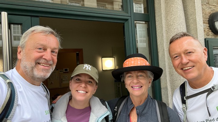
Today we had Kathryn and Tessa (aka Mike and Mike) with us as we headed out on the final day of our pilgrimage to Santiago de Compostela.

Following yesterdays heavy thunderstorm the skies were pretty overcast this morning as we walked into town to have our breakfast in the misnamed Gourmet Arca. The pilgrims breakfast was basic but at least the coffee was good.

O Pedrouzo is a small village that has been built up for the Camino de Santiago and, for most walkers, is the last stop before Santiago. The parish church we saw yesterday has a famous scallop-shaped altar and is a reconstruction of the original chapel that burned down at the end of the 19th century, when Spain was at war with Cuba and the devotees went from O Pedrouzo to Compostela to pray for the victory of their country.

We walked out of town and straight into a forest section of the walk, as has been the case for a lot of the last couple of days. A few hills, some cheeky, and we emerged from the trees so see the sky still overcast, but clearing, and a nice spash of colour with two cows grazing in a field of wild flowers.

We walked for a while around the perimeter of Santiago airport and through the village of San Paio and paid a brief visit to the Capella de Santa Lucia, a 17th century hermitage, for our final stamp before Santiago. There were many examples of the Spanish barns (sheds), some were quite ornate with crosses and other decorations on top.

Coming close to the end now of our epic journey, we walked alongside a babbling stream and a few eucalyptus plantations for a while until we got our first sight of Santiago in the distance. From there it was really a walk into a city and along the pavements (sidewalks!) until we reached the square in front of the cathedral and the famous stone with a carved scallop shell. We had expected a lot more “pilgrims” on the walk today, for some reason this didn’t occur.

Expecting to have to join a long queue to receive our Compestela and certificate of distance we were pleasantly surprised to be “in and out” in less than 10 minutes. Of course a successful walk, and a quick certificate process, warranted an ice cream.

As we are finished walking now, tomorrow is a rest day in Santiago and tomorrows blog will have all the pictures of the cathedral,inside and out, and other interesting places.

The hordes are back!

Today we had Kathryn and Tessa with us, and they stayed for the photo, as we headed towards O Pedrouzo.

Although the region has long been settled, even pre-dating Roman occupation, the current population of Arzúa are mostly of Basque extraction. Notable though is that Arzúa is the Galician municipality with the most cows per capita. The village is, for many pilgrims, the last stopping point before the final day trek into Santiago de Compostela. The Camino Frances and the Camino del Norte join in a single path in Arzúa before arriving in Santiago.

A nice temperature when we set out this morning even though the skies were overcast. We had to take a bit of a meandering diversion in town as part of the marked route was being dug up / repaired. Anyway it was marked clearly and we didn’t lose too much time / increase the distance for the day. We had some heavy rain yesterday afternoon (we were thankfully inside at the time) and this meant that the paths weren’t dusty and all the woods and fields looked a lush green.

Yesterday the huge crowds of people from the previous day didn’t materialise, but they were back today. We could only surmise that folks are taking the bus and skipping the harder stages. Each to their “own” Camino I suppose. The Nortes route merges with the Frances route (as mentioned above) here so that would be one reason for an increase in pilgrims today. You can get a slight feel of the “hordes” from the second photo.

As we walked on there were a few climbs and descents, but nothing like yesterday in scale. The sun was doing its best to shine and we could feel the air warming up. But it was very pleasant walking through the woods as we started one of our downhill sections. All the trees, on both sides, were planted in very formal formations which gave some interesting views but I much prefer the randomness of naturally occurring woodland.

We could hear loud music in the distance as we walked along and I thought it would be good to share what we saw and heard. Even the cows in the field looked unimpressed.

Surprisingly we didn’t walk through any towns today but we did eventually break free of the woodland and into farming country. Obviously early in the growing season as quite a few fields were growing produce but the plants were very small. A couple of distant mountains caught the eye as did a garden full of chickens and chicks (very hard to get a good photo).

Walking down the long descent to O Pedrouzo we saw plenty of eucalyptus trees. These aren’t native to Spain but came to Europe and to Galicia in the 19th century when a Galician monk brought some seeds from the faraway land of Australia where he had been a missionary. The species adapted so well to the local climate that it spread rapidly throughout the territory. Rather than come into town along the main road, we walked to our hotel through a quiet woods at the back of the town, checked in and then strolled up to have a quick look and see when the church would be open for our pilgrims stamp.

Today’s ice cream was early (before 4pm) as the heladeria was open earlier!

Tomorrow is the last day of our walk as we head into Santiago de Compostela.

Up and down like a …… yo-yo!

Today we had Tessa and Kathryn with us as we headed to Arzúa.

Today started well, the cafe that the hotel pointed us to for breakfast was closed so, after only a coffee from somewhere nearby, we headed off. We truly did have Tessa and Kathryn with us but they had already started when the photo was taken! It felt colder than the predicted 15c when we set off and the sky was overcast – forecast was a lot of rain about 2pm.

Palas de Rei was a bit disappointing as a town, considering all of the old towns/villages we had been through recently. It is assumed that the name of the town comes from Pallatium regis (royal palace) as it was the residence of the Visigothic monarch Witiza at the beginning of the 8th century. The Calixtino Codex states that, from this point the final stage to the apostle’s tomb, 68 kilometers away, is a journey that Amery Picaud defined as “moderate”.

It was nice to start the day by walking downhill for once, as we walked out of Palas de Rei, on wooded paths and past plenty of (now that we know what they are) traditional Spanish barns. We stopped at the Igrexa de San Xulían do Camiño (Igrexa is church in Galician whilst Iglesia is church in Spanish) in the town of O Coton to get our daily Pilgrim Passport stamp. This also had the benefit of passing a large number of people congregated there and at the cafe (much easier to pass here than on the paths). We crossed the Rio Pambre, looking pretty with reflected sunlight as we reached the foot of our first descent.

The day would be a series of descents and ascents as we started our first climb, staying on wooded paths with the occasional breaks in the trees giving views of distant hills. In the town of O Coto we stopped to buy some cherries. Not a perfect breakfast substitute but very tasty anyway. We crossed the Rio Furelos as we walked through Furelos, on the outskirts of Melide (which was halfway on our journey today).

Another series of ups and downs as we passed through a few small towns with churches and also a brand new barn which looked very smart indeed. We had some rain, enough to get our coats out and on for at least 5 minutes and then once the rain stopped the heat returned so off came the coats – thankfully they weren’t needed again. At this stage the sun was out and it was quite hot and humid, not ideal for stomping up hills. The herds of cows we saw seemed to be enjoying it though.

One final, long, descent and we stopped for a bite to eat (25km and no breakfast) before the final climb up to Arzúa. The skies were darkening in the background as we enjoyed the views, and one spectacular field of dandelions, and finally made it (exhausted) to our hotel.

A bit of a rest, a wander and a couple of coffees as we waited for the ice cream shop to open (its always 4pm) and then a delicious ice cream.

Tomorrow we head to O Pedrouzo.

Our first rainbow

Tessa and her mother, Kathryn, are joining us for the next few days, and today we headed to Palas de Rei.

Not too cold this morning and, with the forecast of potential rain, overcast as we headed out of Portomarin.

The Codex Calixtinus refers to the town as “Pons Minee”, which has been interpreted as ‘Puente del Miño’. This bridge, along with the one in Lugo and the one in Orense, was the only way to cross the Miño without using a boat, which is why the pilgrims’ route had to pass through here. Additionally, “marín” is also related to the existence, since the High Middle Ages (9th-12th centuries) of a sanctuary consecrated to Santa María, on which the church of San Nicolás or San Juan would later be built.

The first picture shows the view we had at dinner last night, and the quality of the food matched the view for definitely the best meal of the Camino so far. Walking out of Portomarin meant going back down the steps and then we crossed the Miño by a different bridge and started straight up a hill via a wooded path. There was a route choice next – either the main route or a “complementary” route, which we took. This seemed to allow us to bypass most of the hordes this morning.

All was well as we ambled through the countryside, no rain yet but the clouds were moving steadily in. Plenty of farms / houses with the small buildings in the second picture above, some research indicates that they are traditional Spanish barns. The countryside is definitely more agricultural now with some large farms visible and the small towns we walk through being mainly farm buildings.

More barns in the gardens of largish houses and then we experienced our first raindrops of the day. This necessitated raincoats which are good for keeping rain out and, because it was still quite humid, good for keeping sweat in. The rain only lasted a few minutes and then formed the first rainbow of this walk. Looking at the hills in the distance, we could see some heavy rainfall that was heading away from us. A few up and downs in the road and then we started our descent to Palas de Rei, mostly by road with the odd rocky path thrown in for good measure.

After one more rain shower the sun started to show again as we walked on, spotting some small villages hidden behind wooded areas. We then passed the Igrexa de Santiago de Lestedo and took the opportunity for a look inside and another stamp in our passport. Following this it was a straightforward walk into Palas de Rei and a check in to our hotel.

Yes, after lunch and when the heladeria opened, it was ice cream time! Today was longer than yesterday and with more metres of ascent but, I suspect due to the weather being cooler, it didn’t feel quite as hard work.

Tomorrow is the longest day left as we head to Azrua.

Hordes of 100km’ers

Today we said goodbye to Mike and headed to Portomarin

Bit of a chill in the air this morning as we set off, the forecast was for something much hotter as the day progressed.

King Alfonso IX – considered by many to be the creator of the modern Camino way – founded the royal villa of Vilanova de Sarria at the end of the 12th century , a strategic point on his itinerary to Compostela. He also died in Sarria in 1230, a victim of a serious ailment, during a pilgrimage to Santiago again to thank the Apostle for the reconquest of Mérida. Sarria is also a major starting point the the Camino Frances as, being 114km from Santiago, it is the last place you can start and still receive the Compostela.

Crossing the Rio Pequeno via a pretty bridge, we walked alongside, and then crossed, the railway line. There are four trains a day that go through Sarria, 2 in the morning and 2 in the evening. Starting up a steepish hill (what else would there be first thing after breakfast) on a wooded path we started to see evidence of Sarria being the start point for so many pilgrims. In the first 30 minutes alone we passed over 100 other pilgrims (and over 300 by the end of the day), this was more like a commercial charity walk than anything we had seen on the Camino so far.

It was very pleasant walking after we had passed the majority of early starters. As usual the scenery was lovely to look at and although we didn’t walk through any towns, there were a few nestling in dips in the hills. All this time the sun was rising and there wasn’t a cloud to be seen, making it pretty warm. We were in t-shirts and shorts, and sweltering, many other walkers still had hats, jumpers or coats and full length trousers, I will never understand how they don’t collapse from heat exhaustion.

A small church and cemetery, a few nice splashes of colour and more nice views as we walked along and arrived at the “most photographed spot”, the 100km to go marker. Why people have the need to graffiti everything is beyond me.

Starting our descent we could see Portomarin in the distance and as we got closer the descent got steeper, not good for our knees, and we came to the Vella Bridge across the Rio Miño. The reservoir of Belesar, on the Rio Miño, necessitated the moving of Portomarin to a higher altitude and flooded the old village. Major buildings, such as the churches of St. John and St. Nicholas, were dismantled and rebuilt stone by stone. At the end of a tough day walking, there is a long staircase to navigate before getting into the town itself.

After checking in, we had a stroll round town and a spot of lunch, before retiring out of the heat for a bit of rest and recuperation.

Tomorrow we head to Palas de Rei.