The B&B was very nice with a very good breakfast this morning. The forecast was for a reasonably clear day so we set off on our walk to Belfast with raincoats stowed in backpacks.


Bangor has a long and varied history, from the Bronze Age people whose swords were discovered in 1949, to the Victorian pleasure seekers who travelled on the new railway from Belfast to take in the sea air. The city has been the site of a Gaelic Irish monastery renowned throughout Europe for its learning and scholarship, the victim of violent Viking raids in the 8th and 9th centuries, and the new home of Scottish and English planters during the Plantation of Ulster. We decided that today we would walk as much of the coast path (The Ulster Way) as possible and we joined the path just outside the Bangor Marina. There were new beaches to see every few hundred metres, some sandy and some quite rocky.


More beaches, nice views of the water through the trees, a walk on the beach at Helen’s Bay and sight of Grey Point Fort. This is a battery that was part of the defences of Belfast. Construction of the battery began in 1904, with the guns mounted by 1907 (and another battery on the opposite side of the Lough at Kilroot). The battery was armed with two 6-inch Mark VII Breech loading guns. During the First World War additional buildings were constructed to provide accommodation for men of Kitchener’s Army. During the Second World War During the Second World War concrete overhead covers were added to both gun positions. Following the war. the battery continued to be maintained with a mobile radar being installed in 1954 until disarmed in 1956.


As we continued towards Belfast on the coast path there were plenty of seagulls dropping molluscs from a height to break open their shells. We saw the ferry leaving from Belfast port, the Royal Northern Ireland Yacht Club, wind turbine blades ready for shipment (they are huge!) and a Celebrity Cruise Line (I think all the passengers were at the Titanic Exhibition. As we finished walking through the dockland there was a large ship (the SeaRose) in for a £61m refit.


As we were too early check in to our hotel we paid a visit to the Titanic Exhibition. It was interesting to see the history of Belfast ship building as well as, obviously, the building of the Titanic which even included a small theme park type ride (but very sedate). The actual hitting an iceberg and sinking was such a catalogue of avoidable errors but the one that stood out for me was the Captain, despite knowing there was ice in the area, refusing to reduce speed in the belief they could stop in time. The iceberg was spotted 1/4 mile away – the Titanic at full speed needed 1/2 mile to stop.


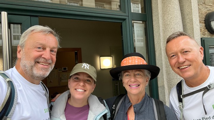
Just as we got to the city centre the heavens opened (literally!) and also treated us to a hail storm. We had to shelter in a nearby doorway until it passed – shortly afterwards warm sun and blue skies! Tomorrow we will have Helena and Hugh walking with us as we head up to Larne.